Publicizing geospatial and meta data at the national geoportal by local self-government bodies - recommendations
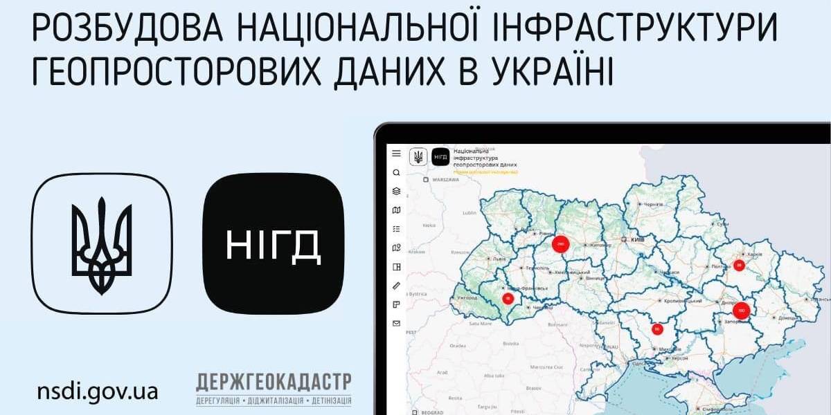
Ukraine is undergoing the process of creating, functioning and developing the national infrastructure of geospatial data. Under the legislation, executive bodies and local self-government are obliged to publicize geospatial and meta data at their official websites and reflect them with the help of the access service at the national geoportal.
The national geoportal prototype is functioning in the experimenting exploitation mode (nsdi.gov.ua), administered by the public enterprise «Scientific and research institute of mapping and geodesy». At the portal, 689 sets of geospatial data from the national, regional and local levels are available for browsing, downloading and processing.

Tags:
amalgamation of hromadas spatial planning
Source:
Державна служба України з питань геодезії, картографії та кадастру
14 July 2026
Олексій Марченко: «Не сумніваюся у тому, що до нас повернеться 90% наших мешканців…»
Олексій Марченко: «Не сумніваюся у тому, що до...
Начальник Лазурненської селищної військової адміністрації Херсонської області Олексій Марченко про громаду, яка...
13 July 2026
Анонс: вебінар «Розширення програми...
До участі запрошуємо представників обласних військових адміністрацій, керівників...
13 July 2026
Відбулася зустріч «Розширення програми...
10 липня відбулася зустріч «Розширення програми безоплатного шкільного харчування з 1 вересня 2026 року: виклики,...
13 July 2026
Adaptive model for activities of local state...
The current model for activities of local state administrations has become less and less suited to the conditions...