Publicizing geospatial and meta data at the national geoportal by local self-government bodies - recommendations
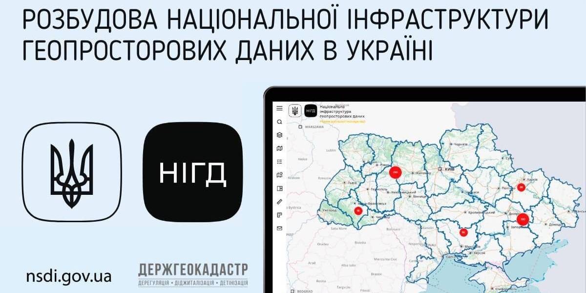
Ukraine is undergoing the process of creating, functioning and developing the national infrastructure of geospatial data. Under the legislation, executive bodies and local self-government are obliged to publicize geospatial and meta data at their official websites and reflect them with the help of the access service at the national geoportal.
The national geoportal prototype is functioning in the experimenting exploitation mode (nsdi.gov.ua), administered by the public enterprise «Scientific and research institute of mapping and geodesy». At the portal, 689 sets of geospatial data from the national, regional and local levels are available for browsing, downloading and processing.

Tags:
amalgamation of hromadas spatial planning
Source:
Державна служба України з питань геодезії, картографії та кадастру
24 December 2025
Окупована, але нескорена Шульгинка. Інтерв’ю начальниці військової адміністрації
Окупована, але нескорена Шульгинка. Інтерв’ю...
Начальниця військової адміністрації окупованої Шульгинської сільської громади Луганської області Наталя Петренко...
23 December 2025
Швейцарська підтримка сприятиме реалізації...
5 агенцій регіонального розвитку отримають гранти на реалізацію стратегічних пріоритетів у рамках програми...
23 December 2025
Open Call: Partnership in Preserving and Improving Access to Public Services
Open Call: Partnership in Preserving and...
The Swedish–Ukrainian Polaris Programme: Supporting Multilevel Governance in Ukraine announces a call to support...
22 December 2025
Статут демократії: Криничанська громада серед перших в Україні прийняла новий ключовий документ
Статут демократії: Криничанська громада серед...
Незважаючи на складну безпекову ситуацію, громади Дніпропетровської області не припиняють роботу над побудовою...