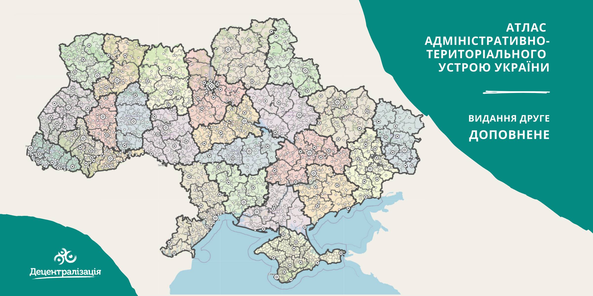
A collection of maps of administrative and territorial arrangement of Ukraine is available at the Decentralisation portal
- The second, updated edition of the collection of maps of administrative and territorial arrangement of Ukraine, including new rayons and territorial hromadas has appeared.
«Hromadas, rayons, population and the area are covered by the collection of maps. We tried our utmost to make it simple and easy to perceive and process the information. I think it will be helpful to high school pupils and students too. With time we are going to improve it», - commented Pavlo Ostapenko, the idea author and editor-in-chief of the collection of maps.

Tags:
administrative and territorial structure rayon Pavlo Ostapenko
Source:
Прес-центр ініціативи «Децентралізація»
13 February 2026
Територіальні громади 2025: ключові зміни та їхні наслідки
Територіальні громади 2025: ключові зміни та...
Пропонуємо увазі читачів «Децентралізації» ґрунтовний аналітичний матеріал, підготовлений експертами KSE Institute —...
13 February 2026
Language of Development: Narrative Glossary of Key Terms of EU Cohesion Policy
Language of Development: Narrative Glossary of...
The European Union has its own “language of development.” It is the language used to write strategies, allocate...
13 February 2026
Плани Комітету, позиція Мінрозвитку та...
У Києві відбулася підсумкова конференція «Місцеве самоврядування та територіальна організація влади в Україні на...
12 February 2026
Анонс: вебінар «Особливості проведення...
Запрошуємо керівників органів управління освітою, управлінські команди закладів освіти та юристів органів місцевого...