


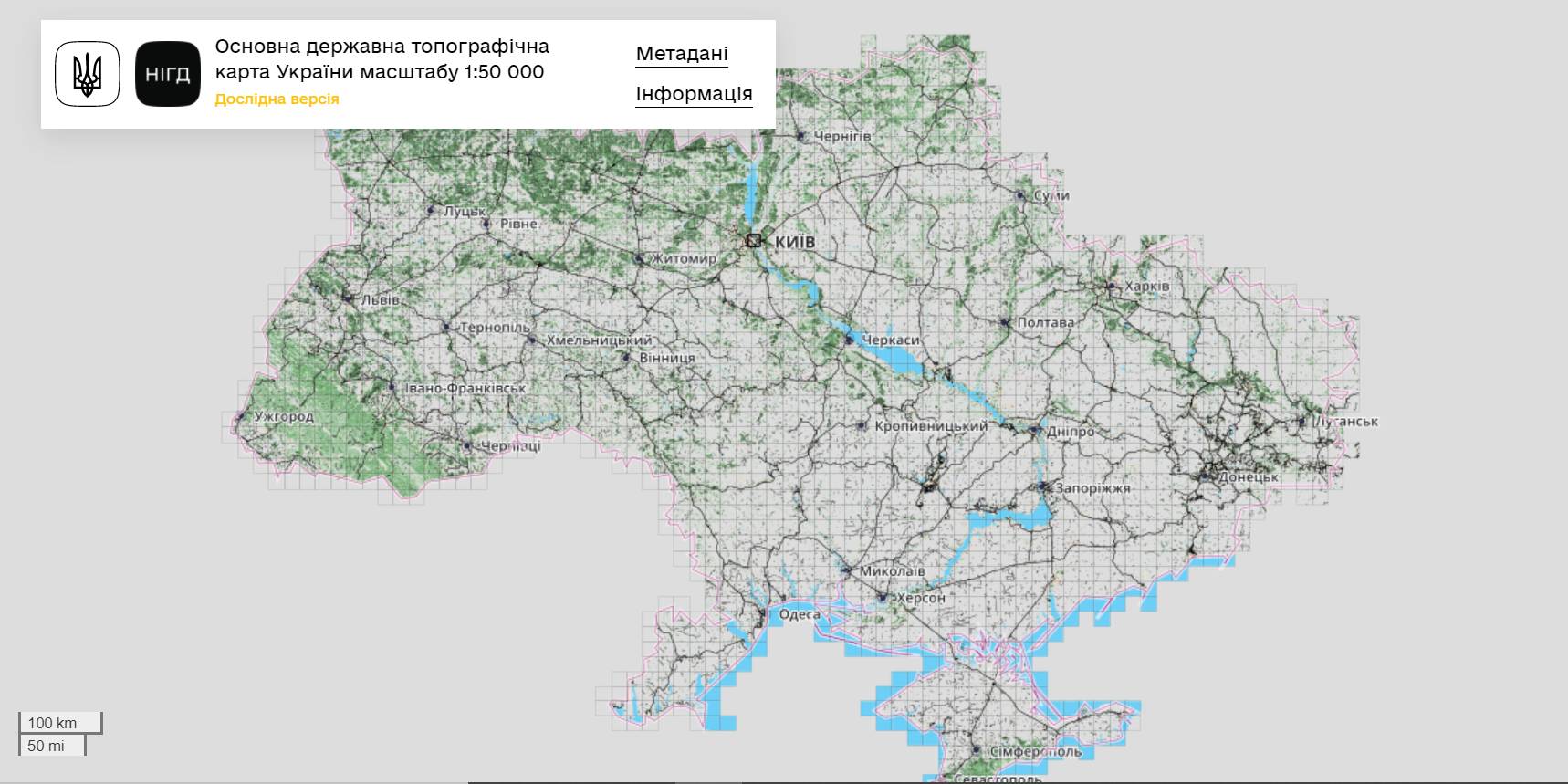
The StateGeoCadastre has publicized the Main State Topographic Map with the scale of 1:50 000
The StateGeoCadastre has created (updated) a digital topographic map with the scale of 1:50 000, as well as the topographic data basis of the territory of Ukraine.
The work was done within a joint project with the Mapping Service of the Kingdom of Norway «Maps to facilitate the proper land management in Ukraine» in 2018–2021.
On January, 27, 2022, the Map was presented during the online-conference.
The Director on International Services of the Mapping Service of the Kingdom of Norway Hans Christian Munthe Kaas emphasized the professional approach of the Ukrainian partners and underlined the significance of digital initiatives development and geospatial data accessibility in Ukraine.
The Map is available at: https://nsdi.gov.ua/map50k.

Share the news:
10 June 2025
Соціальна згуртованість через діалог і культуру: практики Міжгірської громади
Соціальна згуртованість через діалог і...
Авторка: Тетяна Лукеря, соціологиня, дослідниця у Київській школі економіки Соціальна згуртованість у громадах...
10 June 2025
Вакансія! Експерт/ка з управління публічними інвестиціями
Вакансія! Експерт/ка з управління публічними...
Проект RFA шукає експерта/ку з управління публічними інвестиціями, що очолить ініціативи з розробки політики та...
10 June 2025
U-LEAD’s recently released Concept Paper is a...
The recently released U-LEAD Concept Paper offers guidelines for Ukraine towards better regional policy alignment...
10 June 2025
Перепрофілювання закладів освіти не є реорганізацією: ухвалюємо рішення правильно (запис вебінару)
Перепрофілювання закладів освіти не є...
Швейцарсько-український проєкт DECIDE провів вебінар на тему: «Перепрофілювання не є реорганізацією: приймаємо...