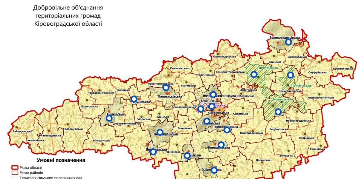
Interactive map of amalgamated hromadas appeared in Kirovohrad Oblast
An interactive map of amalgamated hromadas was created in the Kirovohrad Oblast, as reported by the Kirovohrad Local Government Development Centre.
The interactive map reflects the boundaries of existing and perspective AHs – there are 14 of them. There are also three hromadas – the Novoprazka, Pryiutivska and Dmytrivska AHs, where the first elections were scheduled for the spring 2018.
The Hruzkivska and Maryanivska AHs have already received conclusions from the oblast state administration and are in the process of filing documents to the CEC regarding the appointment of the first elections.
The map is available by the link: https://www.thinglink.com/scene/1032922678643654659

Область:
Кіровоградська областьSource:
Кіровоградський Центр розвитку місцевого самоврядування
19 December 2025
Locally-led Recovery Planning: How Polaris Strategic Sessions Work
Locally-led Recovery Planning: How Polaris...
The Polaris Programme continues to provide systematic support to hromadas under its Locally-led Recovery sphere. In...
19 December 2025
Бориславська міська рада затвердила новий Статут громади
Бориславська міська рада затвердила новий...
Сьогодні, 18 грудня, Бориславська міська рада прийняла історичне рішення, затвердивши Статут Бориславської міської...
19 December 2025
Public Finance for Children (PF4C) Ukraine's State Budget 2026 Overview
Public Finance for Children (PF4C) Ukraine's...
UNICEF Ukraine has prepared a brief overview of Ukraine’s State Budget for 2026, with a focus on financing for social...
19 December 2025
Питання релокації пожежно-рятувальних...
“Велика війна” зумовлює не завжди очевидні виклики для територіальних громад. Хоча законодавчі органи активно...