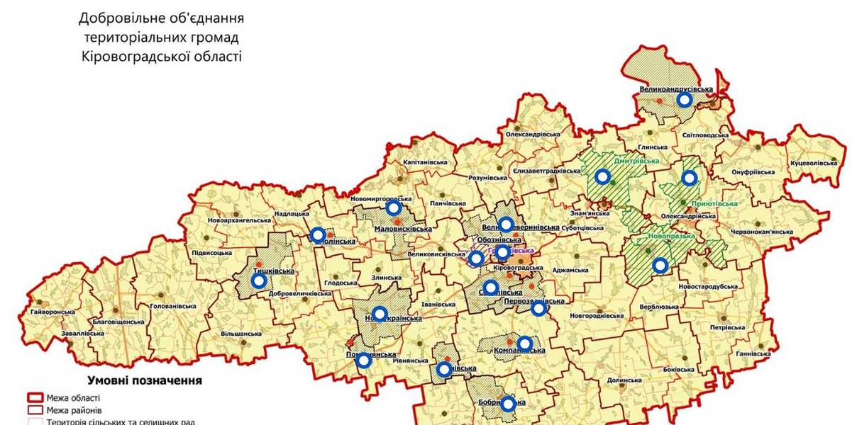
Interactive map of amalgamated hromadas appeared in Kirovohrad Oblast
An interactive map of amalgamated hromadas was created in the Kirovohrad Oblast, as reported by the Kirovohrad Local Government Development Centre.
The interactive map reflects the boundaries of existing and perspective AHs – there are 14 of them. There are also three hromadas – the Novoprazka, Pryiutivska and Dmytrivska AHs, where the first elections were scheduled for the spring 2018.
The Hruzkivska and Maryanivska AHs have already received conclusions from the oblast state administration and are in the process of filing documents to the CEC regarding the appointment of the first elections.
The map is available by the link: https://www.thinglink.com/scene/1032922678643654659

Область:
Кіровоградська областьSource:
Кіровоградський Центр розвитку місцевого самоврядування
31 July 2026
BIM має стати єдиною системою управління інформацією про об'єкти будівництва
BIM має стати єдиною системою управління...
Заступниця міністра з відновлення, інфраструктури та транспорту України Наталія Козловська взяла участь в...
31 July 2026
Громади Європи: рішення місяця
Громади Європи: рішення місяця
липень 2026 Українські громади дедалі глибше входять у європейський політичний, правовий та професійний...
31 July 2026
ДФРР-2026 за новими правилами: хороша ідея, яка призупинилась через юридичну колізію
ДФРР-2026 за новими правилами: хороша ідея, яка...
З прийняттям постанови Кабінету Міністрів України від 8 липня 2026 р. № 883 «Деякі питання державного фонду...
31 July 2026
Уряд розподілив кошти для 130 майбутніх академічних ліцеїв на створення сучасних освітніх просторів
Уряд розподілив кошти для 130 майбутніх...
Загалом майже 700 мільйонів гривень отримають 130 майбутніх академічних ліцеїв у 22 областях України — уряд завершив...