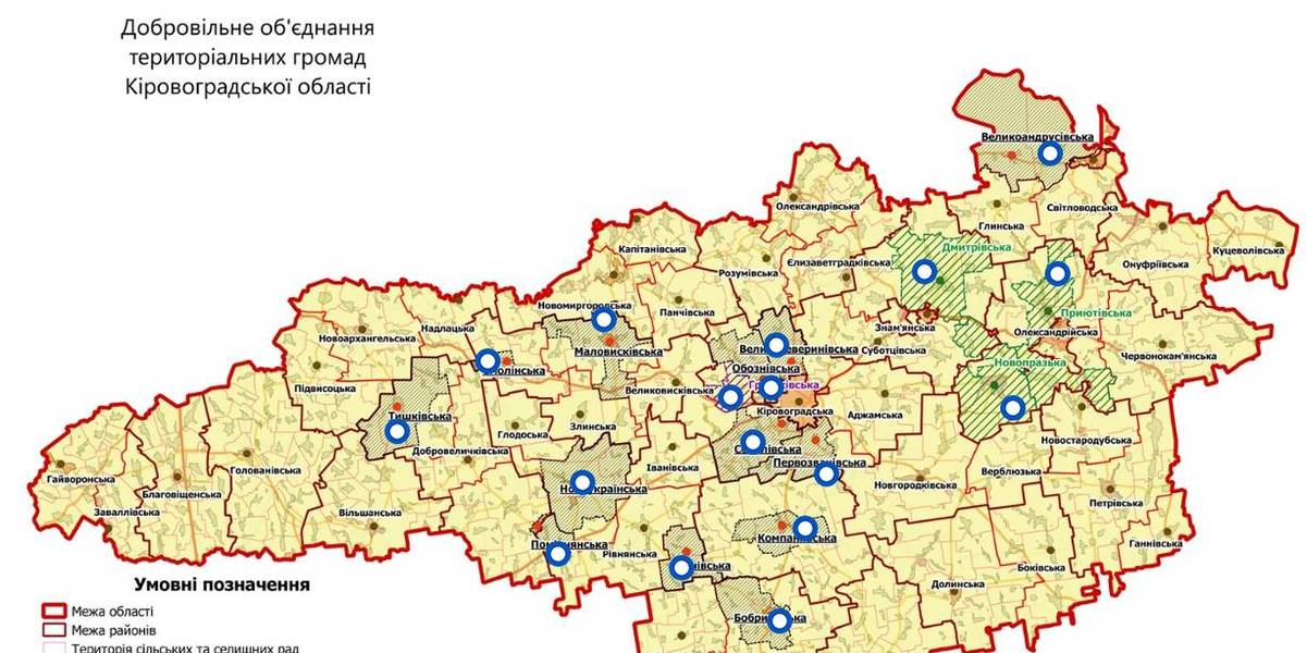
Interactive map of amalgamated hromadas appeared in Kirovohrad Oblast
An interactive map of amalgamated hromadas was created in the Kirovohrad Oblast, as reported by the Kirovohrad Local Government Development Centre.
The interactive map reflects the boundaries of existing and perspective AHs – there are 14 of them. There are also three hromadas – the Novoprazka, Pryiutivska and Dmytrivska AHs, where the first elections were scheduled for the spring 2018.
The Hruzkivska and Maryanivska AHs have already received conclusions from the oblast state administration and are in the process of filing documents to the CEC regarding the appointment of the first elections.
The map is available by the link: https://www.thinglink.com/scene/1032922678643654659

Область:
Кіровоградська областьSource:
Кіровоградський Центр розвитку місцевого самоврядування
22 June 2026
Бібліотекарі громад Харківщини вивчали досвід сучасних бібліотек Польщі
Бібліотекарі громад Харківщини вивчали досвід...
Десять бібліотекарів із Валківської, Богодухівської, Краснокутської та Коломацької громад Харківської області взяли...
22 June 2026
Моніторинг громад – травень 2026
Моніторинг громад – травень 2026
Як змінюється стан справ у територіальних громадах? Як на їхню спроможність впливають безпекові умови в регіонах та...
22 June 2026
Олексій Рябикін: Наступний етап реформи...
У Львові відбулася зустріч у «страсбурзькому форматі», присвячена ролі районних рад у сучасній системі місцевого...
22 June 2026
Естетика як стратегія: як профтех в...
«Я передумала, я не буду тут вчитися!» – ці слова, супроводжувані істерикою, директорка...