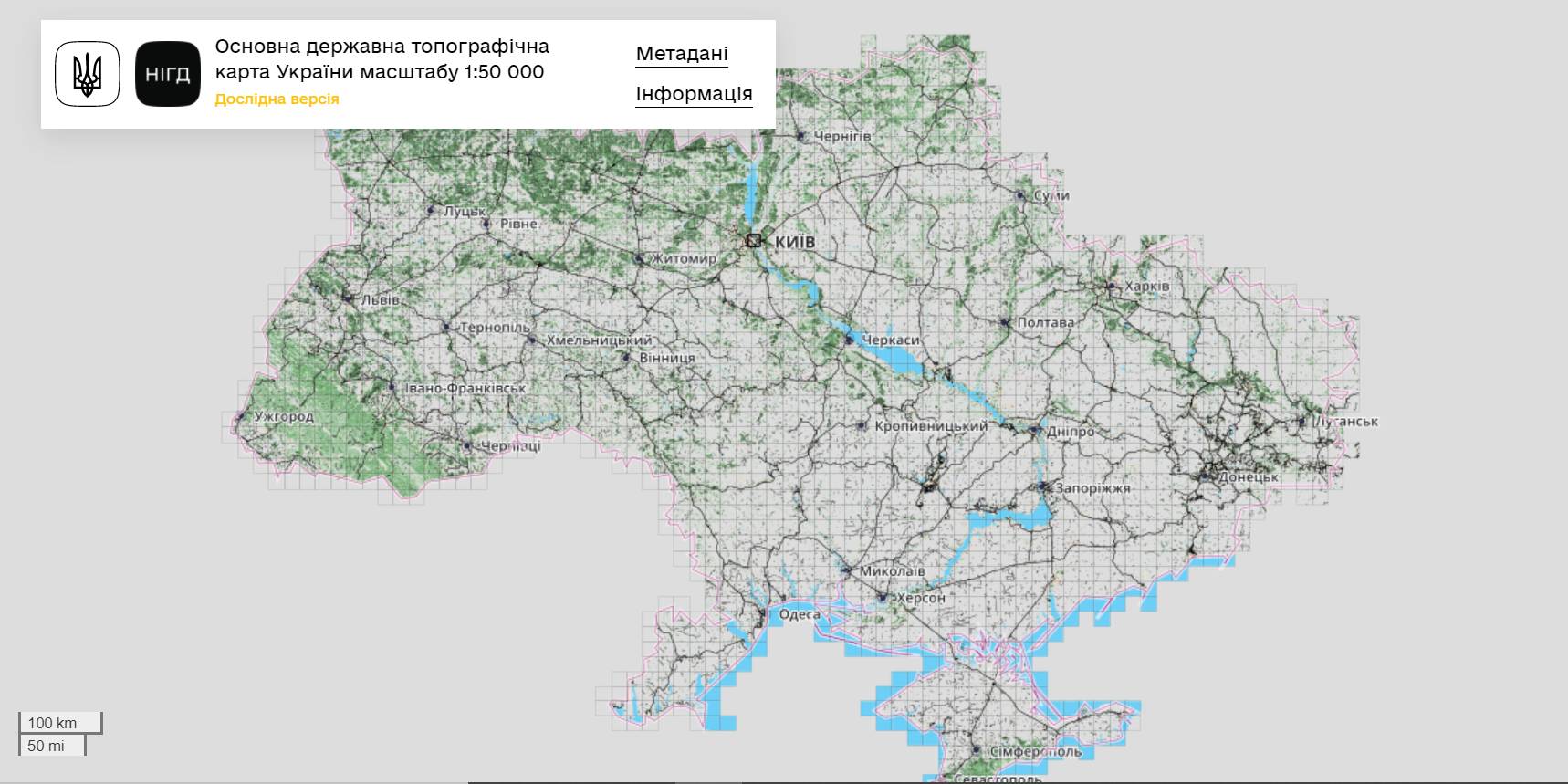
The StateGeoCadastre has publicized the Main State Topographic Map with the scale of 1:50 000
The StateGeoCadastre has created (updated) a digital topographic map with the scale of 1:50 000, as well as the topographic data basis of the territory of Ukraine.
The work was done within a joint project with the Mapping Service of the Kingdom of Norway «Maps to facilitate the proper land management in Ukraine» in 2018–2021.
On January, 27, 2022, the Map was presented during the online-conference.
The Director on International Services of the Mapping Service of the Kingdom of Norway Hans Christian Munthe Kaas emphasized the professional approach of the Ukrainian partners and underlined the significance of digital initiatives development and geospatial data accessibility in Ukraine.
The Map is available at: https://nsdi.gov.ua/map50k.

17 February 2026
Sylna hromada: Systemic recovery as the foundation for Ukrainian resilience
Sylna hromada: Systemic recovery as the...
Four years of Russia's full-scale war against Ukraine have led to the massive destruction of critical infrastructure,...
17 February 2026
Уряд затвердив порядок надання субвенції на розвиток ветеранських просторів у 2026 році
Уряд затвердив порядок надання субвенції на...
11 лютого 2026 року Кабінет Міністрів України ухвалив Постанову №180, якою затверджено Порядок та умови надання у...
16 February 2026
«Гранти – не манна небесна»: як прикордонна...
Коропська громада, що на Чернігівщині, розташована в зоні підвищеної небезпеки через близькість до кордону з рф. Тут...
16 February 2026
Вебінар «Досвід ЄС у підготовці...
25 лютого 2026 року о 11:00–13:40 шведсько-українська Програма Polaris «Підтримка багаторівневого врядування...