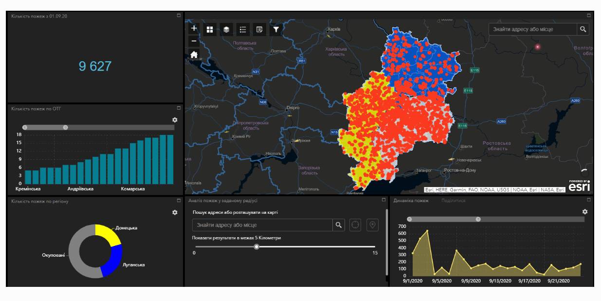
Fire monitoring and analysis maps have been developed for municipalities of eastern Ukraine
Within the project “No smoking” it was suggested that a geo-analytical tool (map) of fire monitoring and analysis should be developed on the basis of operational satellite and retrospective information on fires for the last five years for the purpose of efficiently planning preventive measures aimed at fighting large scale fires in municipalities. According to the competitive selection results, ten municipalities of the Donetsk and Luhansk oblasts. Moreover, regional maps enabling to analyze fire condition and dynamics for the last five years on the territory of the two oblasts.
The map has been developed on the basis of NASA satellite data, Public Cadastre Map, Nature Reserve Fund, including a set of information and analytical tools in terms of fire dynamics, location and scale, the area damaged by fire, etc.
Feel free to get acquainted with the developed maps at municipality sites or at https://cid.center/e-solutions/.

Tags:
Область:
Донецька область Луганська областьSource:
Центру розвитку інновацій
03 August 2026
Більшість правил Європейського AI Act набули чинності: що це означає для місцевого самоврядування
Більшість правил Європейського AI Act набули...
2 серпня 2026 року в Європейському Союзі почала застосовуватися більшість положень Закону про штучний інтелект - EU...
03 August 2026
Korosten economic miracle. Interview with Volodymyr Moskalenko, Mayor of Korosten
Korosten economic miracle. Interview with...
Volodymyr Moskalenko, Mayor of Korosten, who has been in office for 28 years, talks about how to ensure sustainable...
01 August 2026
З прийняттям постанови Кабінету Міністрів України від 8 липня 2026 р. № 883 «Деякі питання державного фонду...
31 July 2026
BIM to become unified system for managing information on construction projects
BIM to become unified system for managing...
Nataliia Kozlovska, Deputy Minister for Recovery, Infrastructure and Transport of Ukraine, took part in the Ukrainian...