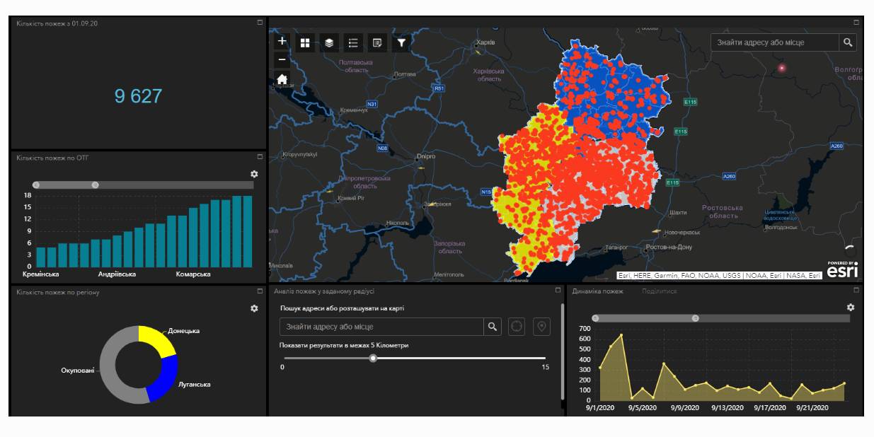
Fire monitoring and analysis maps have been developed for municipalities of eastern Ukraine
Within the project “No smoking” it was suggested that a geo-analytical tool (map) of fire monitoring and analysis should be developed on the basis of operational satellite and retrospective information on fires for the last five years for the purpose of efficiently planning preventive measures aimed at fighting large scale fires in municipalities. According to the competitive selection results, ten municipalities of the Donetsk and Luhansk oblasts. Moreover, regional maps enabling to analyze fire condition and dynamics for the last five years on the territory of the two oblasts.
The map has been developed on the basis of NASA satellite data, Public Cadastre Map, Nature Reserve Fund, including a set of information and analytical tools in terms of fire dynamics, location and scale, the area damaged by fire, etc.
Feel free to get acquainted with the developed maps at municipality sites or at https://cid.center/e-solutions/.

Tags:
Область:
Донецька область Луганська областьSource:
Центру розвитку інновацій
16 February 2026
«Гранти – не манна небесна»: як прикордонна...
Коропська громада, що на Чернігівщині, розташована в зоні підвищеної небезпеки через близькість до кордону з рф. Тут...
16 February 2026
Вебінар «Досвід ЄС у підготовці...
25 лютого 2026 року о 11:00–13:40 шведсько-українська Програма Polaris «Підтримка багаторівневого врядування...
16 February 2026
‘We did not even know we were happy’: Interview...
Life in the border community before the war seemed normal: school, hospital, roads, work, sports, plans for...
13 February 2026
Територіальні громади 2025: ключові зміни та їхні наслідки
Територіальні громади 2025: ключові зміни та...
Пропонуємо увазі читачів «Децентралізації» ґрунтовний аналітичний матеріал, підготовлений експертами KSE Institute —...