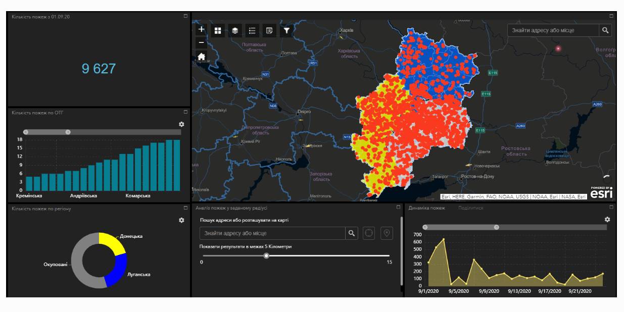
Fire monitoring and analysis maps have been developed for municipalities of eastern Ukraine
Within the project “No smoking” it was suggested that a geo-analytical tool (map) of fire monitoring and analysis should be developed on the basis of operational satellite and retrospective information on fires for the last five years for the purpose of efficiently planning preventive measures aimed at fighting large scale fires in municipalities. According to the competitive selection results, ten municipalities of the Donetsk and Luhansk oblasts. Moreover, regional maps enabling to analyze fire condition and dynamics for the last five years on the territory of the two oblasts.
The map has been developed on the basis of NASA satellite data, Public Cadastre Map, Nature Reserve Fund, including a set of information and analytical tools in terms of fire dynamics, location and scale, the area damaged by fire, etc.
Feel free to get acquainted with the developed maps at municipality sites or at https://cid.center/e-solutions/.

Tags:
Область:
Донецька область Луганська областьSource:
Центру розвитку інновацій
23 June 2026
EURegionsWeek 2026 відкрила реєстрацію на партнерські сесії
EURegionsWeek 2026 відкрила реєстрацію на...
Відкрито реєстрацію на партнерські сесії European Week of Regions and Cities (EURegionsWeek) 2026 —...
23 June 2026
Анонс. Круглий стіл «Повноважність місцевих рад в умовах воєнного стану»
Анонс. Круглий стіл «Повноважність місцевих рад...
Дата: понеділок, 29 червня 2026 року Час: 11:00 - 12:30 Місце проведення: Українське національне інформаційне...
23 June 2026
24 червня – панельна дискусія “Розбудова...
Як ефективне стратегічне планування може слугувати інструментом пріоритезації під час управління публічними...
23 June 2026
Ужгород і португальська Майа стали містами-побратимами
Ужгород і португальська Майа стали...
Ужгород розширив мережу міжнародних партнерств, уклавши угоду про співробітництво з португальським містом Майа....