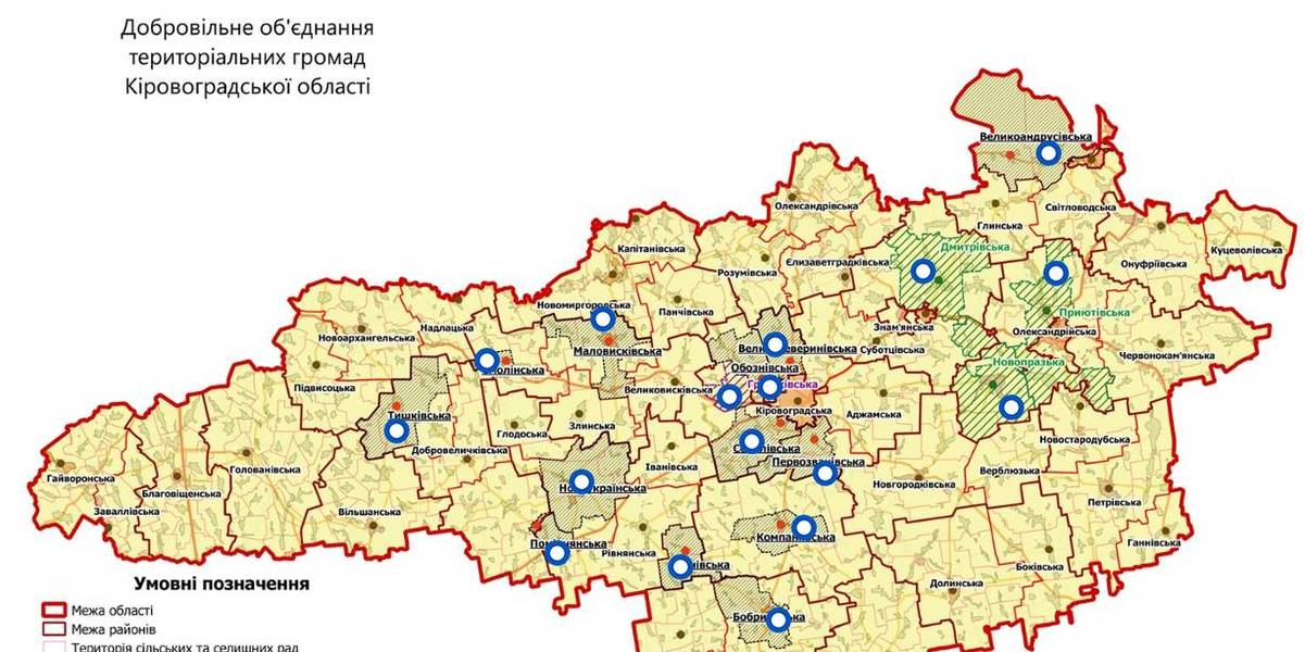
Interactive map of amalgamated hromadas appeared in Kirovohrad Oblast
An interactive map of amalgamated hromadas was created in the Kirovohrad Oblast, as reported by the Kirovohrad Local Government Development Centre.
The interactive map reflects the boundaries of existing and perspective AHs – there are 14 of them. There are also three hromadas – the Novoprazka, Pryiutivska and Dmytrivska AHs, where the first elections were scheduled for the spring 2018.
The Hruzkivska and Maryanivska AHs have already received conclusions from the oblast state administration and are in the process of filing documents to the CEC regarding the appointment of the first elections.
The map is available by the link: https://www.thinglink.com/scene/1032922678643654659

Область:
Кіровоградська областьSource:
Кіровоградський Центр розвитку місцевого самоврядування
13 December 2025
Межа у 300 операцій: як формальний критерій може знищити хірургію в малих громадах
Межа у 300 операцій: як формальний критерій...
Поки країна зосереджена на викликах війни — у сфері охорони здоров’я ухвалюються рішення, наслідки яких можуть стати...
13 December 2025
Уряд затвердив оновлені підходи до реалізації...
Кабінет Міністрів України ухвалив документ «Особливості реалізації Концепції реформування місцевого самоврядування та...
12 December 2025
French experience for Ukrainian communities:...
During their visit to France, members of the Ukrainian Parliamentary Committee on State Administration, Local...
12 December 2025
Коли знання запускають участь: як Здолбунівська...
Авторки: Тетяна Лукеря, Олександра Койдель – Центр демократичної стійкості (Київська школа економіки) Частина...