


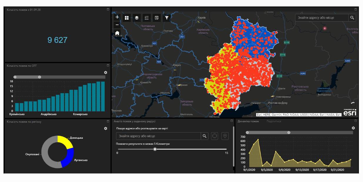
Fire monitoring and analysis maps have been developed for municipalities of eastern Ukraine
Within the project “No smoking” it was suggested that a geo-analytical tool (map) of fire monitoring and analysis should be developed on the basis of operational satellite and retrospective information on fires for the last five years for the purpose of efficiently planning preventive measures aimed at fighting large scale fires in municipalities. According to the competitive selection results, ten municipalities of the Donetsk and Luhansk oblasts. Moreover, regional maps enabling to analyze fire condition and dynamics for the last five years on the territory of the two oblasts.
The map has been developed on the basis of NASA satellite data, Public Cadastre Map, Nature Reserve Fund, including a set of information and analytical tools in terms of fire dynamics, location and scale, the area damaged by fire, etc.
Feel free to get acquainted with the developed maps at municipality sites or at https://cid.center/e-solutions/.

Tags:
Область:
Донецька область Луганська областьSource:
Центру розвитку інновацій
Share the news:
11 July 2025
Війна одна на всіх. Чоп і Куп’янськ - братерство попри відстань
Війна одна на всіх. Чоп і Куп’янськ -...
На YouTube-каналі «Пліч-о-пліч: згуртовані громади» вийшов новий епізод подкасту «Згуртовані». У черговому випуску...
11 July 2025
«Хочемо не затамовувати подих під час тривоги,...
Авторка: Марія Булейко (Марковська) До повномасштабного вторгнення в підвальному приміщенні Чернігівської...
10 July 2025
Draft law allowing for renaming communities...
On 10 July, the Parliamentary Committee on the Organisation of State Power, Local Self-Government, Regional...
10 July 2025
Відтермінування розробки комплексних планів...
10 липня парламентський Комітет з питань організації державної влади, місцевого самоврядування, регіонального...